Highlighting your geographic data with web maps

We create maps with Mapbox and other geographic tools
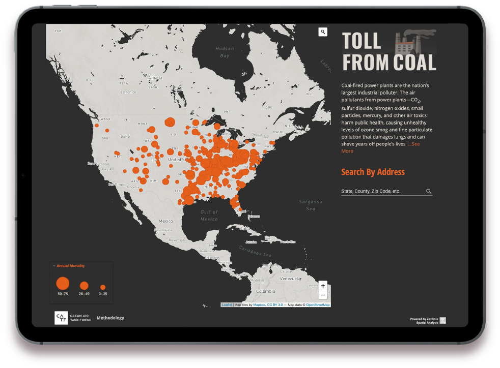
We design and build map applications with powerful geographic tools like the Mapbox, Leaflet and Google APIs as well as other tools like turf.js, PostGIS and Tableau.We are cartographers who know how to work with spatial data
We're not just web developers we are cartographers who understand how to visualize spatial data and work with R, ArcGIS, QGIS and Python to process and prepare data.We are data scientists
We have extensive experience collecting and processing raw data for presentation in interactive maps including census, climate, land use and administrative data.
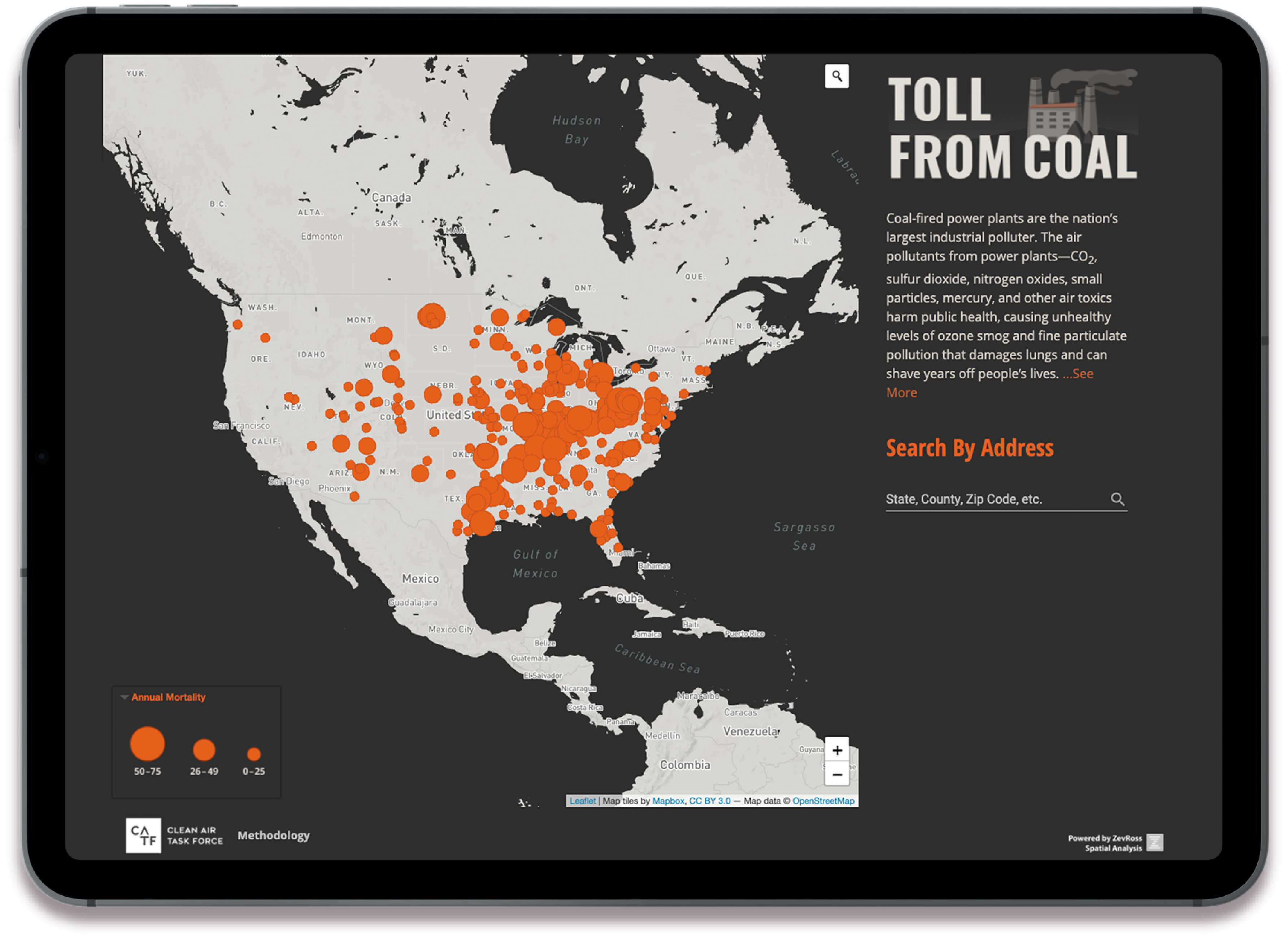
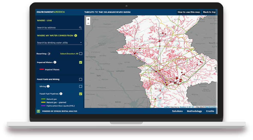
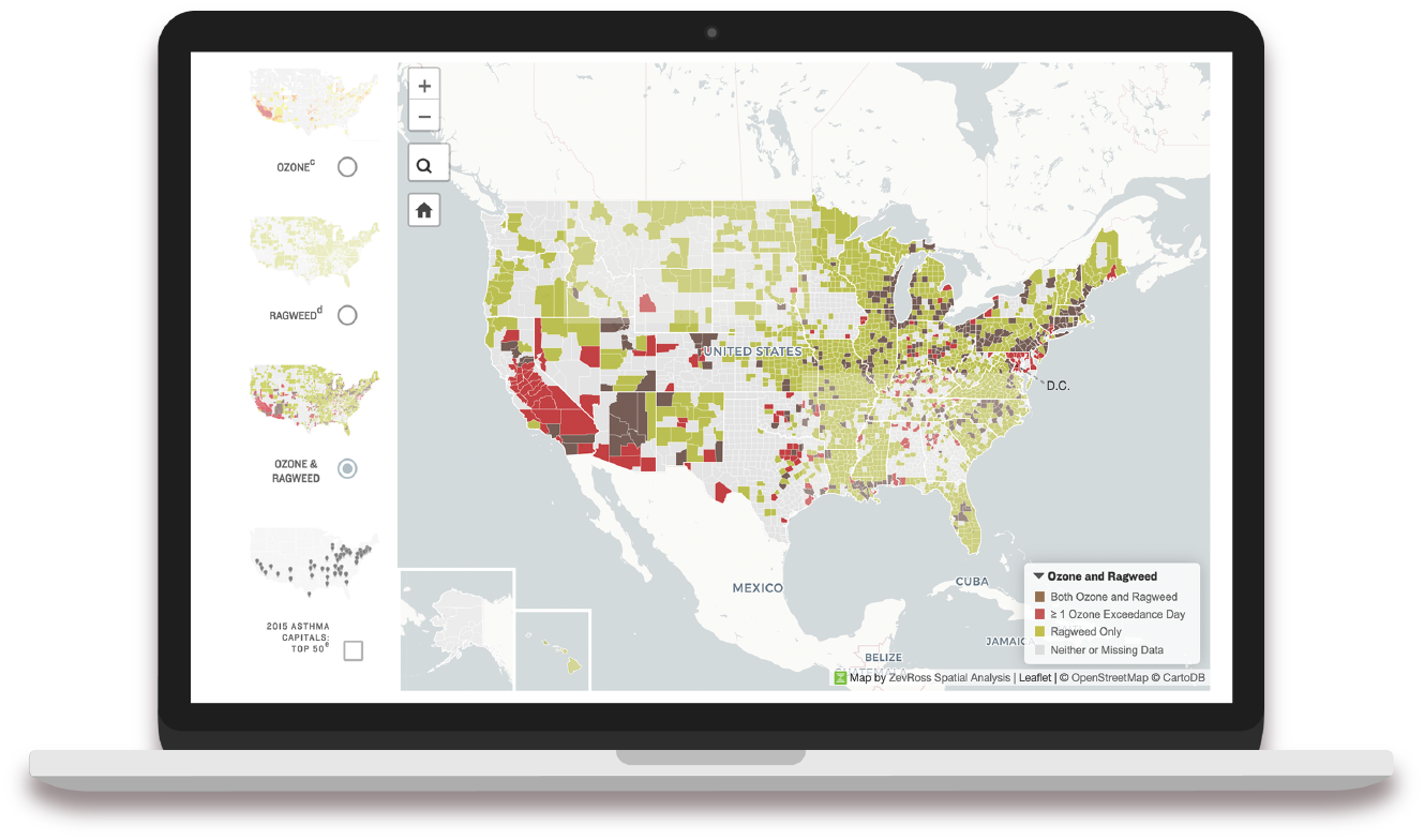
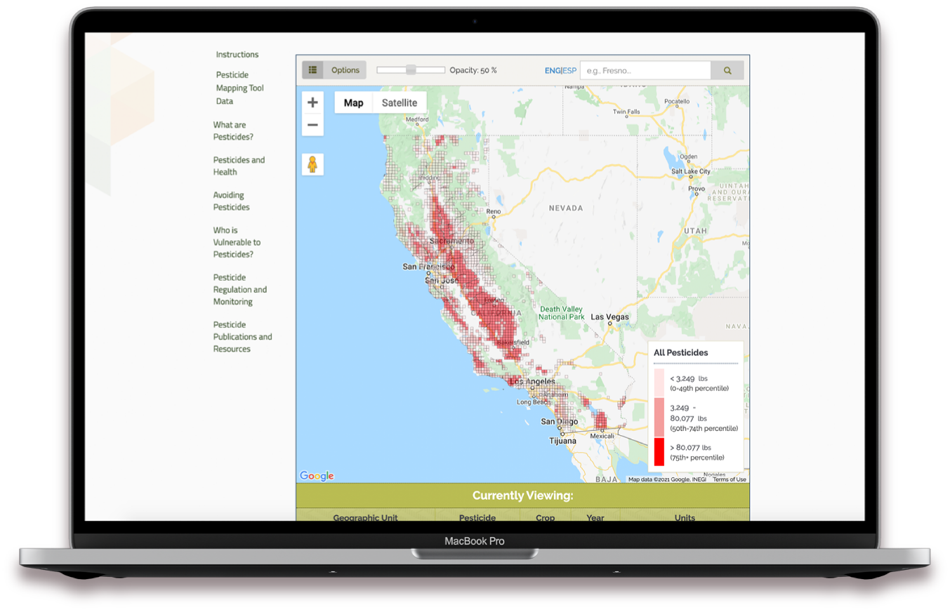
Web maps that highlight client data
Some of our favorite tools

React

Angular

Leaflet

Mapbox

D3

Google Maps

PostGIS

Vue

Highmaps

Tableau