Data science and spatial analysis for the New York City Department of Health
Data Science in Support of Air Quality Research

The project
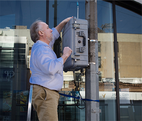
We worked with the New York City Department of Health to develop and implement one of the largest air monitoring networks in the world. Initially funded by Mayor Bloomberg's sustainability plan, the air monitoring network was designed to track air quality through time in all of the City's neighborhoods.
The monitoring network became known as the New York City Community Air Survey NYCCAS and has tracked air quality in the City for nearly a decade.
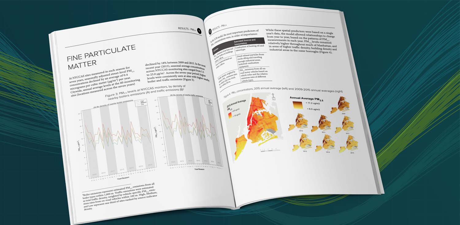
The air survey was able to show remarkable progress in cleaning up NYC's air with a 28% decline between 2009 and 2016 in fine particulate matter and a 27% decline in nitrogen dioxide.
Our role
We have worked with NYC for more than a decade. We were added to the team initially to provide spatial analysis to support decisions about where to place monitors. Once the network was in place we provided data science support in the analysis of data generated by the monitors.
Features of the work
- Conducted spatial statistics to perform geographic network optimization
- Developed an R package to do the seasonal scheduling of monitors
- Co-authored 10 scientific publications featuring the results of analysis
- Computed a wide range of candidate air pollution predictor variables (traffic emissions, tree cover, industrial land use, number of boilers)
- Developed statistical models to predict air quality at unmonitored locations
Tools used

R

Python

ArcGIS/QGIS

PostgresSQL

PostGIS
Made for