Interactive map for Clean Air Task Force
Toll from Coal
The project
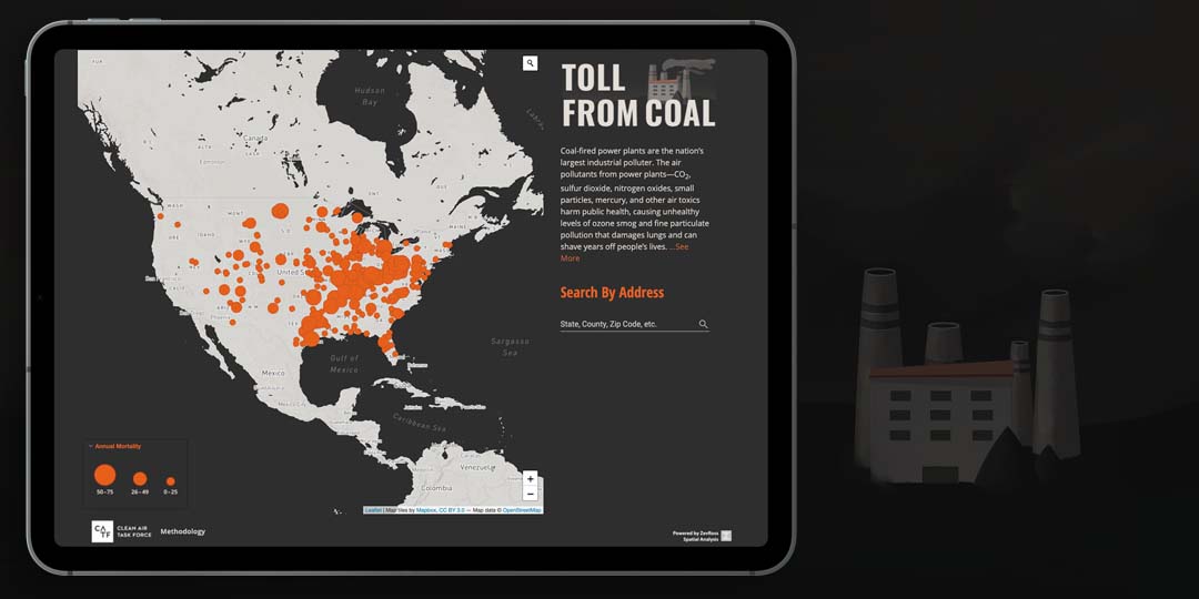
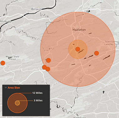
The Toll From Coal mapping application is designed to identify the country's remaining coal-fired power plants and their associated health impacts. It presents map data at the country, state and individual power plant level and includes statistics on estimated mortality and hospital admissions associated with each power plant as well as the at-risk population within 3 and 12 miles.
Our role
We designed and built the mapping application from scratch based on data provided by the client. The application included custom branding and logo design and custom map features for zooming and legends. It also will work offline and can be installed on mobile.
Features of the work
- We used the Leaflet JavaScript library and Mapbox tiles for the maps
- The map features a unique zooming strategy allowing users to zoom to the state level initially and then a plant-level zoom
- Designed with Angular as a PWA (Progressive Web App), the application can be installed with an icon on mobile, and will work offline
Tools used

Leaflet

Mapbox

Angular.js
Made for