Interactive map for the Frontier Group and Environment America
Threats to the Delaware River Basin
The project
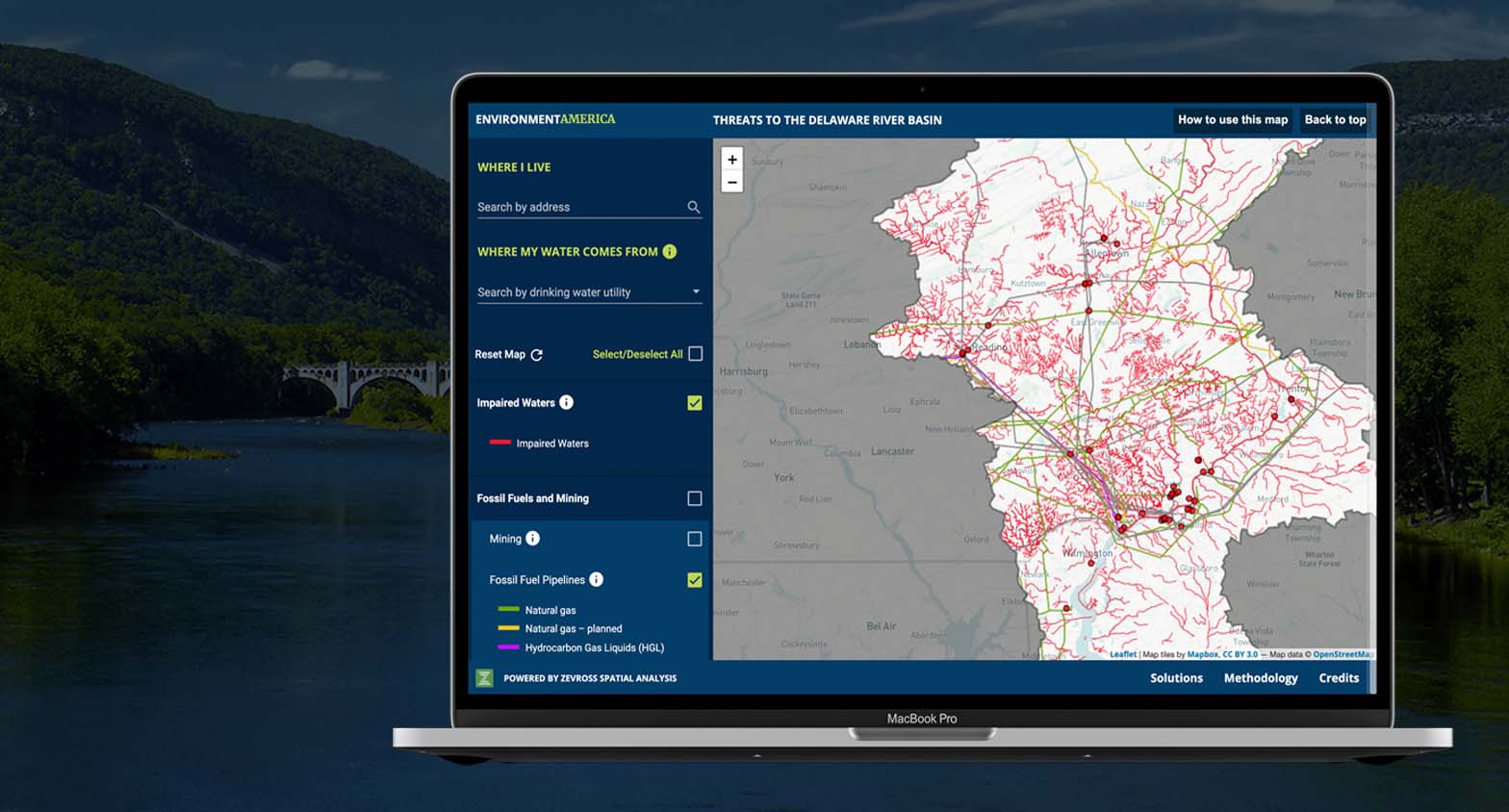
This is a first-of-its-kind interactive map featuring dozens of pollution sources in the Delaware River watershed to highlight the threats facing this important source of drinking water. You can view the map here.
Our role
We developed the web application from start to finish including significant data processing, assembling data in a backend database and creating a custom vector map tile server for lightning-fast rendering. The vector tiles also allowed us to display very complex geographic data, like unsimplified river networks, pipelines and railroads, and filter every layer on the fly.
Features of the work
- We used the Leaflet JavaScript library for mapping
- Custom vector tiles were produced directly from PostGIS
- Angular Material UI was used for mobile first styling and forms
Tools used

Leaflet

Angular

PostgresSQL

PostGIS

NodeJs

NestJs
Made for